Dan Ford
Projects Blog About

    Using ArcMap, R, and Adobe Illustrator to Create Data Driven Infographics

    October 16, 2018  |     azavea.com

    Learn to create a series of data-driven infographics through a project example that evaluates bus performance in each Philadelphia City Council District.

    How to Convert Geodatabase Spatial Data and Related Tables to Vector Tiles

    August 28, 2018  |     azavea.com

    Make spatial data with related tables accessible outside desktop GIS. Use this open source data processing pipeline to convert geodatabase files to vector tiles for use in a web application.

    Exploring Protected Wildlife Habitat for Every Property in New Jersey

    August 27, 2018  |     azavea.com

    This Azavea Research project defines a process for converting big data files to vector tiles and allows a user to identify habitat areas in need of protection.

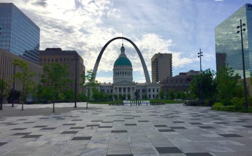
    Trajectory of Geospatial Open Source Innovation Discussed at FOSS4G NA

    May 25, 2018  |     azavea.com

    Presentation summaries on satellite imagery deep learning, Cloud Optimized GeoTIFFs, data to vector tile workflow, and an inspiring keynote. Plus a recap of the Machine Learning After Party we hosted with featured speakers.

    HOTLunch: Volunteer Your Lunch Break to Support Disaster Relief Efforts

    October 02, 2017  |     azavea.com

    In 2017, I organized a recurring volunteer opportunity. Donate your lunch break for HOTLunch to map features that NGOs use to plan aid efforts in response to natural disasters and humanitarian needs.

    Dan Ford