NearLand
This web app bridges the gap between new technology and nonprofit development to create a unique marketing, development, and community engagement tool for a conservation organization.
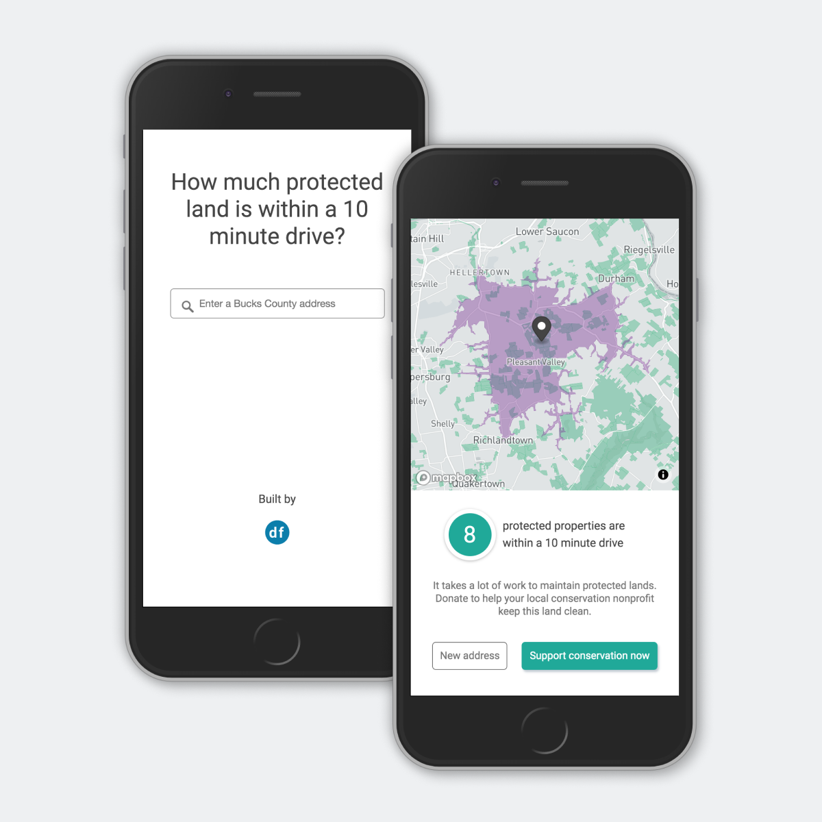
When people communicate distances and location they often use time in place of other measurements. “The store is a 10 minute drive away.” vs “The store is 7.2 miles away.” Using a mapping technique called an isochrone, we can visually show that time as a shape on the map.
I combined this concept with protected land areas to create a website that shows a user preserved land within a 5 minute drive of an address they enter.
The result page shows a map with preserved land and the drive time shape. A message displays based on the count of preserved land within the drive time shape and prompts the user to take action.
The web app is designed to work on any mobile device, tablet, or computer, so it’s accessible and sharable.
Tech
I built the main functionality of Protect Land using JavaScript, leveraging several open source tools. The main functionality of the app is built with Mapbox GL JS.
The web app loads a simple interface that prompts the user to enter an address. I linked the result of the Mapbox Geocoder with the input of the Mapbox Isochrone API to generate the drive time shape based on the address entered by the user.
To learn more about how I created the opening page with an address search box, check out this blog post.
After an isochrone is calculated and a geojson result is rendered, the count of intersecting protected land areas is calculated. The message displayed for the user is dependent on the count of protected land areas.
Goals
- Help a conservation nonprofit raise funds or increase membership
- Create a fun and easy-to-use app for a wide community of users. Basic functionality makes the app quick to use and encourages link sharing.
- Design a tool with accessibility in mind. High contrast colors are friendly for visually impaired users.
Results
- Create buzz about conservation through social sharing
- Raise funds or register members via the call to action
- Elevate a local land trust’s position as an innovator in the development space ⇒ encourage future donors and business sponsors to support a conservation organization’s initiatives